Prescribed burns are meant to reduce bushfire risk. In reality, they are destroying ancient forests and habitats, killing native wildlife and even escaping control to become major wildfires. We bring together the evidence and case studies showing why WA’s current burning practices must change IMMEDIATELY.
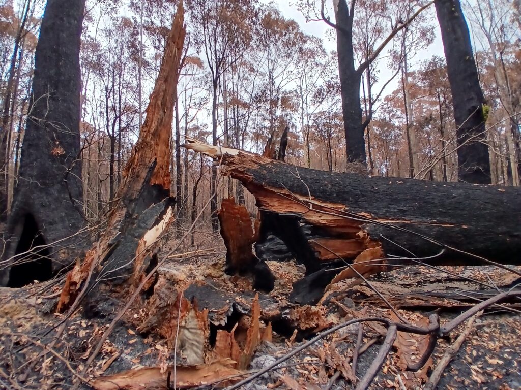
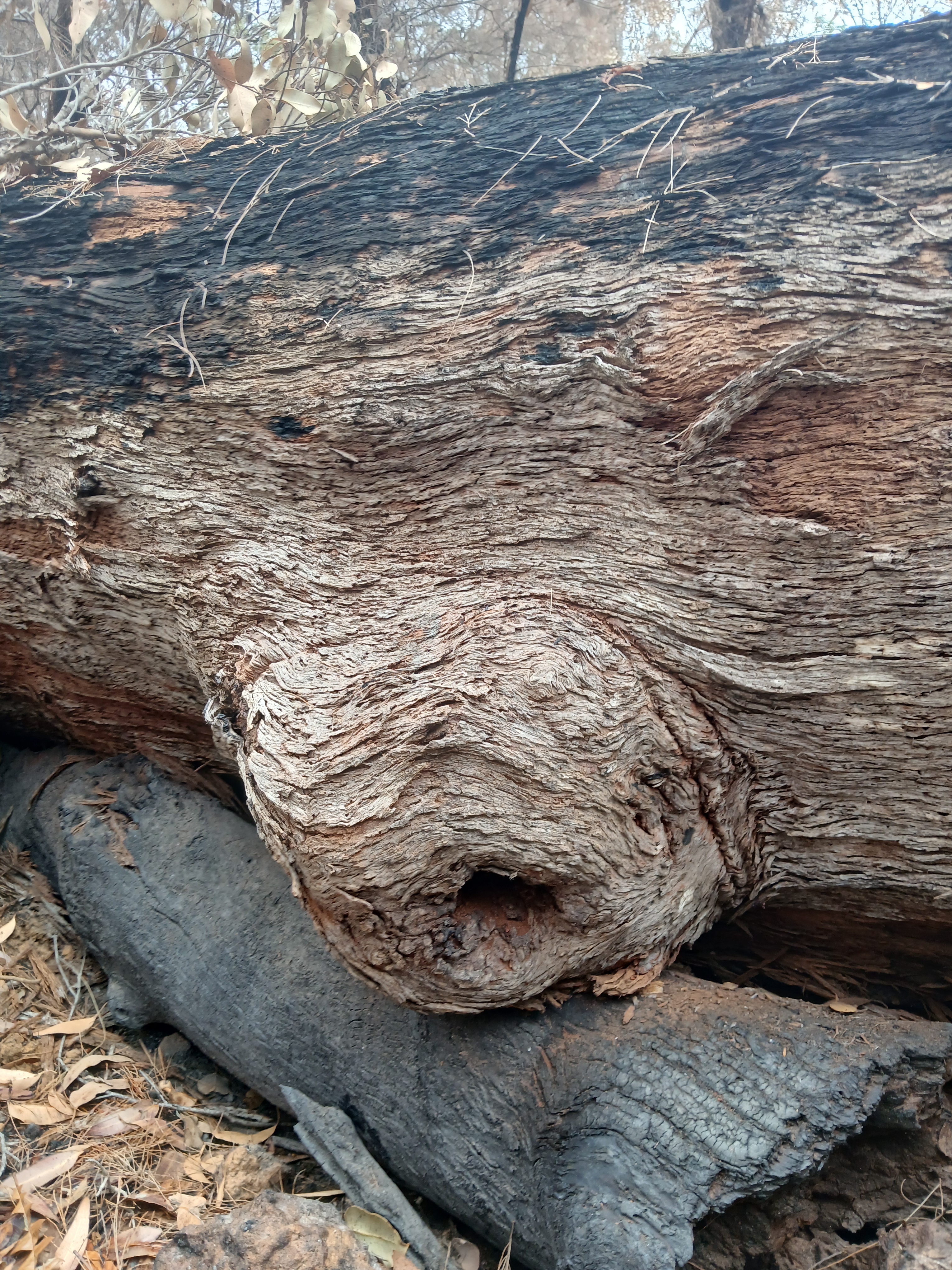
One of many old growth Red Tingle tree collapses from Giants East summer prescribed burn during the prohibited burning period, December 2024 within Walpole-Nornalup National Park, WA.
DANGEROUS, DESTRUCTIVE SUMMER BURN - ANCIENT FOREST INCINERATED
Ancient Tingle Forests Destroyed by “Controlled” Fires
In December 2024, a government-sanctioned summer prescribed burn was undertaken by DBCA in Walpole’s Valley of the Giants during the local government’s prohibited burning period.
This Red Tingle forest burn caused the collapse of over 100 large live trees and numerous other standing dead trees.
Red Tingle forest is found nowhere else on Earth with less than 60km² (6,000 hectares) remaining in the world.
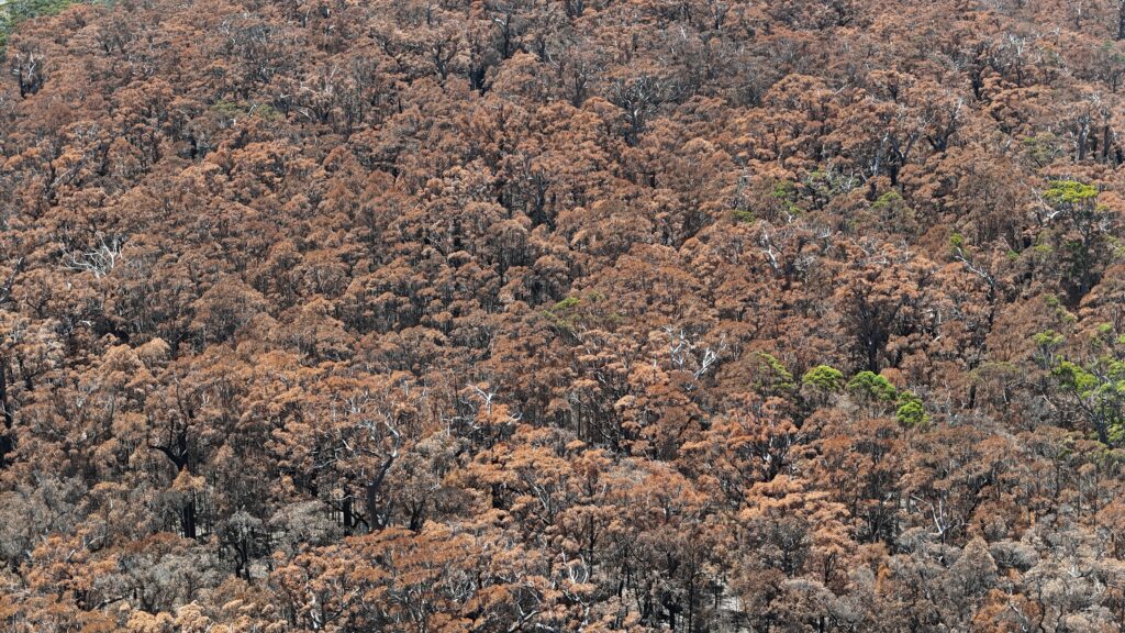
Internal DBCA documents confirmed 100 large live trees and 14 standing dead (stag) trees were destroyed within less than 100 hectares, including 95 tingles, with the majority of the remaining forest suffering severe structural damage and scorched brown tree canopies over 40 metres high.
Conservationists surveying a 28-hectare block within the area burned counted 60 fire-felled giants, estimating a greater loss of 180 trees over the 100-hectare forest.
Weeks later, hollow trunks were still burning like chimneys, trees were still falling and root channels and nearby peatlands were smouldering underground. Months after the burn, trees were still falling.
Hundreds of large nesting and habitat tree hollows for native wildlife collapsed to the forest floor, some found with dead animals within them.
This was a very risky and dangerous burn for DBCA staff to undertake due to the significant tree collapse and falling branches, resulting in numerous safety incidents being documented and reported during this burn.
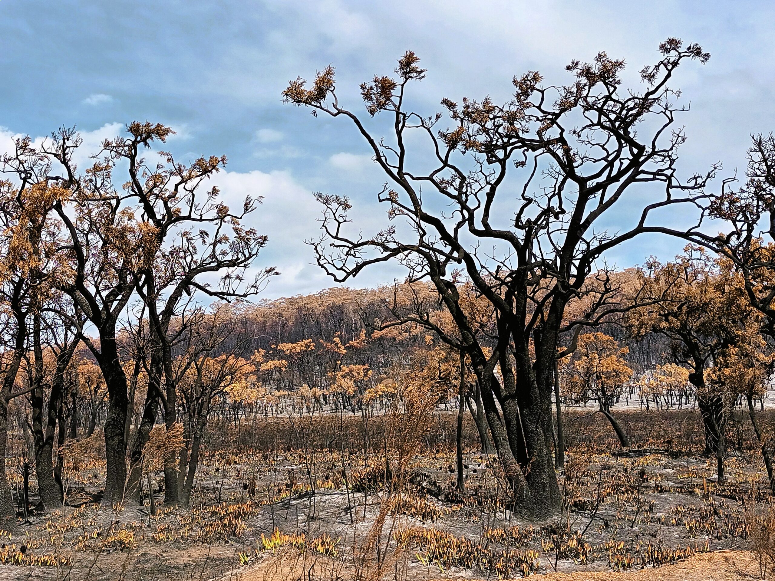
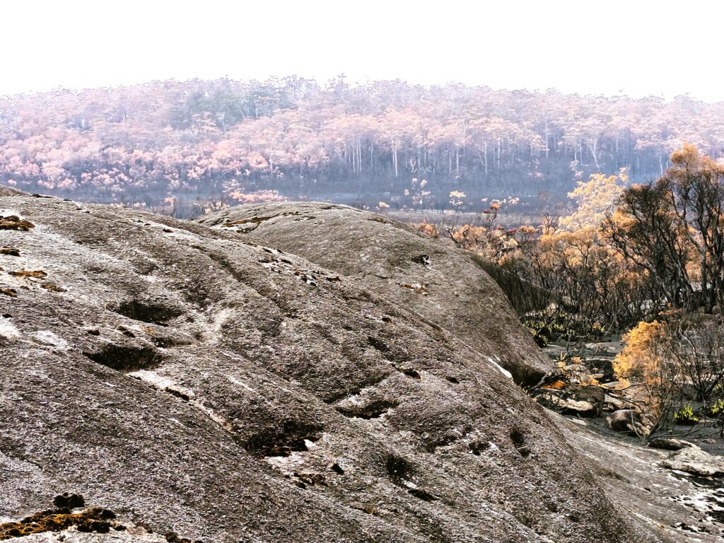
November 2022: A DBCA prescribed burn planned for 15,000 ha near Mount Frankland within the Walpole Wilderness Area, blew out of control, consuming 25,000 ha — an extra 10,000 ha than planned burning through tall forests, granites, peatlands and other biodiverse ecosystems, including old growth forests and fire-sensitive Red-flowering gums.
Suppression costs: $680,000.
Ecologists described the outcome as “devastating to the wilderness”.
Sensitive habitats including old growth habitat trees, peatlands and granite outcrops were torched.
These incidents aren’t isolated. Many prescribed burns have escaped containment boundaries or burned very severely and caused damage to homes, property, stock, wildlife, extensive areas of native vegetation and critical habitats.
In May 2018, a prescribed burn escape in the Stirling Range National Park became a natural disaster that threatened people’s lives and communities, killed hundreds of sheep, devastated native wildlife and vegetation and caused significant damage to farm property and ongoing trauma to farmers and firefighters.
The prescribed fire was planned to burn several thousand hectares of the Stirling Range National Park, but escaped due to strong winds that arrived on 24th May, jumping containment lines and burning through nearly 18,100 hectares. A fifth of this damage occurred on private farmland.
In successive years 2010 and 2011, a series of escaped prescribed burns along the remote coastal area between Augusta and Windy Harbour consumed a total of 67,000 hectares that had not been scheduled to burn.
A fire started at Nannup on 2 December 2011 from a prescribed burn that broke containment lines. It threatened more than 200 homes and forced evacuations in Augusta and Molloy Island. Approximately 55,150 ha were burnt and property was lost.
A 15,000 hectare prescribed burn that escaped to become a wildfire resulted in 25,000 hectares burnt. Mitchell block near Mount Frankland burnt in the Peak-Roe-Crossing prescribed burn escape within Walpole Wilderness Area, North Walpole, WA. Photo: 14th December 2022.
Mitchell block near Mount Frankland burnt as a result of the 15,000 hectare Peak-Roe-Crossing prescribed burn escaping to take out another 10,000 hectares within the Walpole Wilderness Area, North Walpole, WA. Photo: 14th December 2022.
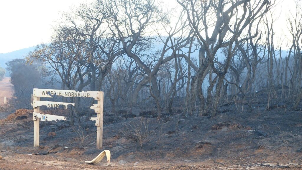
During erratic weather conditions in May 2018, a private property burn escaped containment and destroyed property and burnt through native vegetation in Walpole-Nornalup National Park, including extensive areas of the emblematic, limited distribution Red-flowering gums.
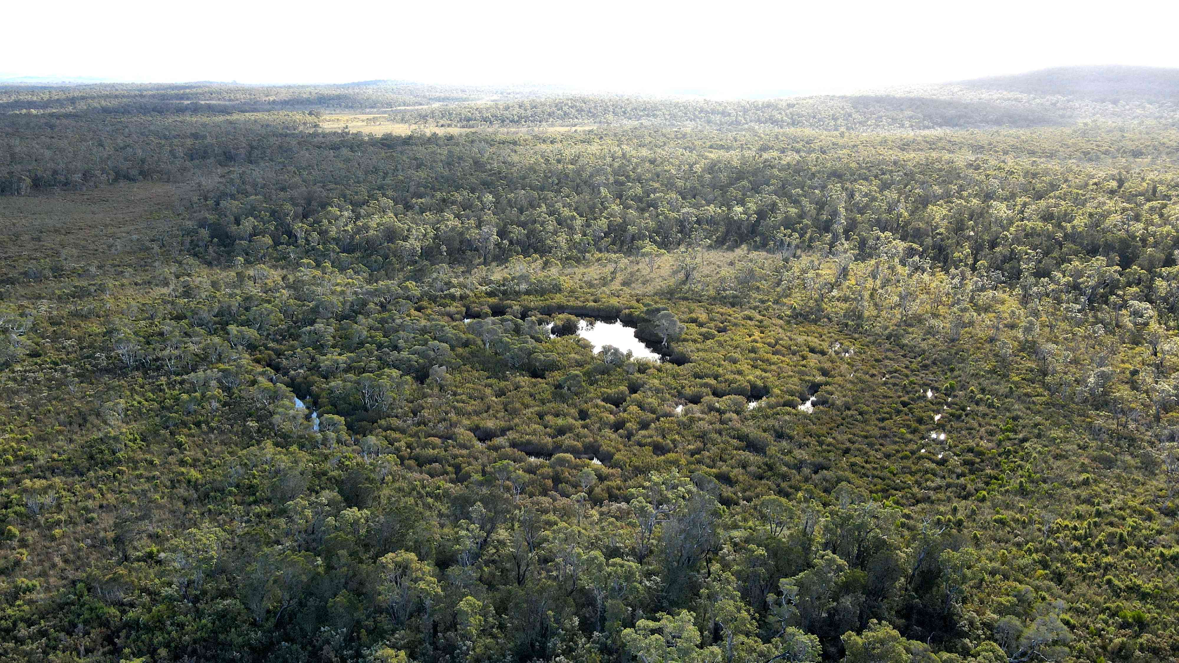
Peatland intact before Styx prescribed burn. They take thousands of years to form and provide vital habitats and carbon sinks.
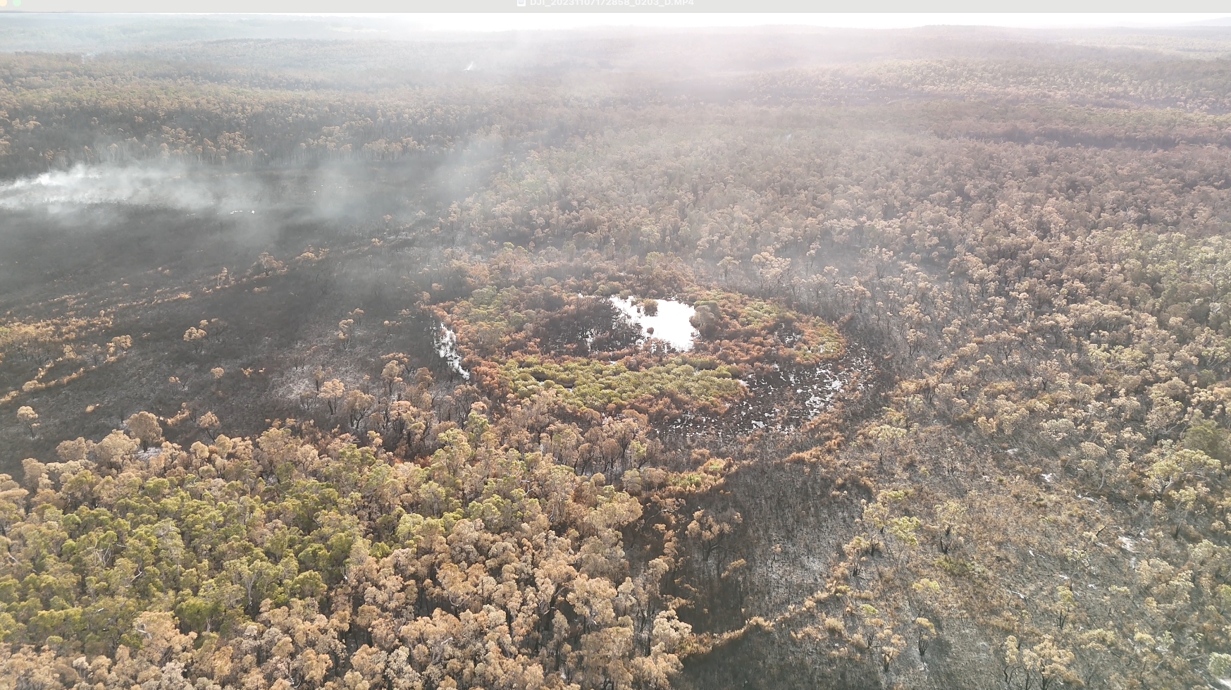
A smouldering landscape. Styx block was ignited by aerial incendiaries in November 2023, decimating Empodisma peatlands, a nationally endangered threatened ecological community.
FRAGILE ECOSYSTEMS BURNT
In November 2023, DBCA burned through the Styx Block, including a peatland near Denmark that had been formally listed as a nationally endangered Threatened Ecological Community just weeks earlier.
Peat Swamps and Endangered Habitats Torched
Area affected: 3,500 ha including irreplaceable peat wetlands.
Conservationist and scientist, Catherine Spaggiari described the amount of destruction as “mind-blowing...it's almost like a tornado has gone through here."
Professor Stephen Hopper warned: “A single fire can take out a peat swamp and it’s 5,000 years to reset the clock”.
Parliamentary data revealed: in the last decade, 22 peat swamps were burned by prescribed fire, versus only 8 by wildfires.
Empodisma peatland is federally listed as an endangeredThreatened Ecological Community, the primary source of that threat is DBCA’s prescribed burning program.
Planned burns often occur during spring and autumn, coinciding with breeding and nesting seasons.
May 2018 Warrungup Spring Reserve prescribed burn: 17 of 22 tracked critically endangered Western Ringtail possums, ngwayir, were killed by a prescribed burn in May 2018 - a 77% mortality rate (Zylstra, 2022).
25th March 2021 Perup prescribed burn, east of Manjimup: up to 65 numbats were killed, injured or displaced — nearly an entire endangered population. The burn lit by DBCA in Perup scorched nearly 1,900 hectares of forest.
November 2024 Blue Holes prescribed burn: critical habitat for quokkas, phascogales, and possums incinerated and wildlife killed.
Scientists warn that inappropriate fire regimes causing biodiversity declines are a Key Threatening Process to more than 800 threatened species and 65 threatened ecological communities in southwest WA.
In tingle, karri and jarrah forests, understorey fuels are densest 10–30 years after fire, making forests seven times more likely to burn compared to longer-unburnt forests.
Associate Professor Philip Zylstra (Curtin University) explains that repeated burns promote dense, highly flammable understorey regrowth, intensifying bushfire risk—"burns in that area are greatly intensifying the bushfire risk."